The Glenwood Springs Citizens’ Alliance and the Colorado Division of Reclamation, Mining and Safety are among those taking a close look at a new geotechnical report that analyzes the Jan. 18 rockslide at the Rocky Mountain Industrials limestone quarry.
The geotechnical report, prepared by by Kilduff Underground Engineering of Denver, was required by by the U.S. Bureau of Land Management as it evaluates RMI’s plans for continued mining at the quarry and the company’s chronic noncompliance problems.
 The report is an eight-page narrative with tables, plus 7 appendices and three illustrations.
The Kilduff report:
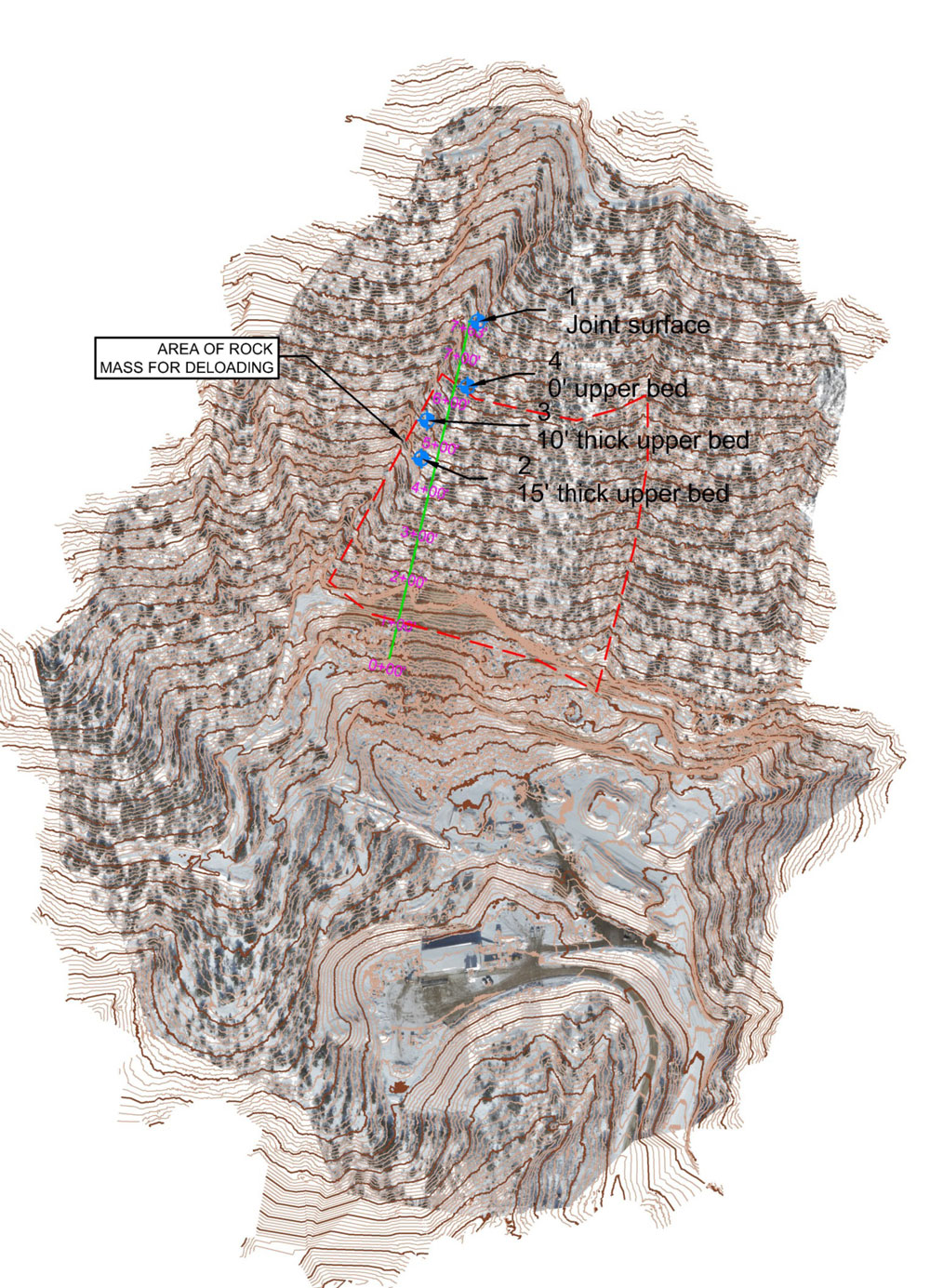
- Describes the steeply pitched limestone layers present in the quarry area.
- Explains how the rockslide occurred on the quarry’s west side.
- Calculates the risk of another slope collapse happening sometime in the future on the quarry’s east side.
- Lays out recommendations for rockfall mitigation to protect workers during ongoing mining.
- Offers strategies for stabilizing the overhanging cliffs so RMI could expand the mine upward on the mountainside.
- Concludes with a recommendation to mine at least 500 vertical feet farther up the mountainside in order to remove the remainder of the limestone layers that collapsed in January.
Rockfall mitigation includes basin, berm
Using slope transects of the rockslide debris pile, Kilduff used geotechnical software to model potential rockfall runout distances if the quarry’s east highwall were to fail. It then created a rockfall runout setback area, with this caution: “No man work shall be performed within the setback without additional stabilization or barriers.”
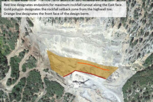
Setback area defined in the Kilduff geotechnical report, from “Figures — Rockfall,” photo 2b. Red line designates endpoints for maximum rockfall runout along the east face. Gold polygon designates the rockfall setback zone from the highwall toe. Orange line designates the front face of the design berm.
To stabilize the setback area, Kilduff calls for excavating rock from the toe of the debris pile to create a catchment basin and constructing a 15-foot-high rockfall berm below the basin that would stop any new rockfall.
It appears that excavating the basin and constructing the berm would require workers to operate within the setback area.
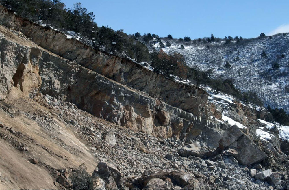
“There is a large overhanging cliff at the top of the quarry, and a massive pile of debris below that contains rocks the size of school buses,” said Michael Gamba, a civil engineer and Citizens’ Alliance board member who led the GSCA’s review of the geotechnical report.
“We can’t picture a way for RMI to build the catchment basin and berm without placing workers inside the setback area. That would pose a serious risk to their lives,” Gamba said.
Meanwhile, the U.S. Mine Safety and Health Administration approved a plan in July that allows RMI limited access to the east production bench of the quarry, below the setback area.
Report made public on Colorado DRMS website
RMI submitted the Kilduff geotechnical report to the U.S. Bureau of Land Management on Aug. 30. As with other documents submitted by the mining company, BLM did not make the geotechnical report public. BLM did forward the report to officials at MSHA and DRMS.
BLM Field Director Larry Sandoval told the GSCA in September that each agency “may have different objectives” in analyzing the geotechnical report. A big question for BLM, he said, will be whether additional ground disturbance is called for.
In mid-September, the Colorado Division of Reclamation, Mining and Safety posted the Kilduff geotechnical report to the archives section of its website, which gave the Citizens’ Alliance an opportunity to download the report.
Colorado DRMS to require Technical Revision to mining permit
During September, an engineering task force at the Colorado Division of Reclamation, Mining and Safety reviewed the Kilduff report, and produced a five-page analysis and critique.
Zach Trujillo, environmental protection specialist with Colorado DRMS, analyzed the Kilduff report and raised nine points that need further work. These include missing information, discrepancies in numerical values, slope stability estimates falling below required factors of safety, and incomplete descriptions of the limestone layers.
The state agency is now requiring RMI to submit a Technical Revision to its state mining permit by Nov. 29.
In an Oct. 24 cover letter to RMI, Amy Yeldell, environmental protection specialist with Colorado DRMS, asked RMI to resolve the issues raised in Trujillo’s review. She also called for an update to the costs for reclamation of the mine to account for “the worst-case scenario for all reclamation tasks.”