The proposed RMI mine expansion would change Transfer Trail forever
How mining would change your use of Transfer Trail
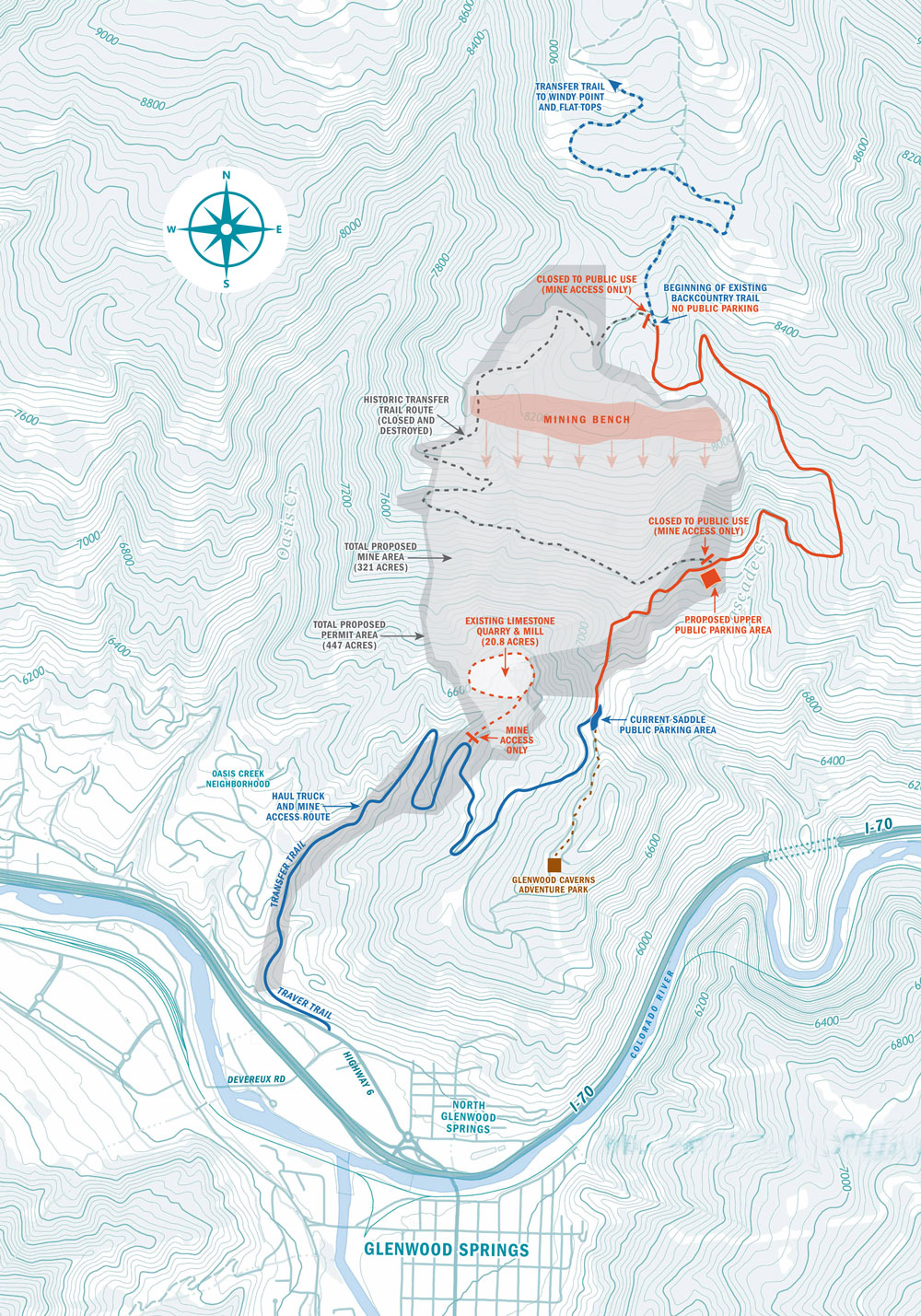
Permanent closure and destruction of the historic zig-zag Transfer Trail route (dotted gray line).
Grading and widening of the modern Transfer Trail route above the saddle parking area (solid orange line).
New public parking a half-mile up the graded section (orange square).
No public parking in 1.7-mile stretch between new public parking area and start of the backcountry Transfer Trail.
Daily mine traffic up and down Transfer Trail to the upper mine gate for mine equipment and worker access.
Heavy rock-hauling truck traffic, up to 450 round trips between 6 a.m. and 6 p.m., from the current quarry gate down Transfer Trail to Highway 6.
Noise and dust from blasting, digging, crushing and loading rock.
Transfer Trail is on public land. We have a say.
The U.S. Bureau of Land Management is reviewing RMI’s mining proposal. Following a public process, BLM can approve or deny the mining plan.
Help us protect the Glenwood Springs community, economy and environment.